For original link click here - http://www.stratfor.com/analysis/georgia_aug_8
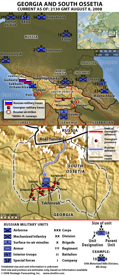
Georgia-South Ossetia Conflict Map

Georgian military units surged into the breakaway republic of South Ossetia on Aug. 7, reportedly after enduring days of shelling by separatist militants. Russia responded forcefully. By the morning of Aug. 8, a vanguard of Russian tanks, armored vehicles and self-propelled artillery had emerged south of the Roki Tunnel and eventually progressed to Tskhinvali, the South Ossetian capital. The exact size and composition of the Russian formation is not clear, though reports have suggested the initial unit involved some 150 vehicles. Units of the 58th Combined Arms Army — which very likely includes elements of the 19th Motorized Rifle Division, based near the border — are thought to be among those that have reached Tskhinvali.
Stratfor has estimated the standing order of battle of the nearby portions of the Northern Caucasus Military District and the nearest Russian base.
The disposition of the Georgian units at this point is even less clear. The furthest line of advance can be estimated and plotted, along with the likely axes of advance based on road infrastructure. However, just where Georgian units are attempting to either hunker down or fall back in the face of the Russian advance is unclear.
Stratfor will continue to update this map as information becomes available. Unit disposition is an approximation based on available information.